


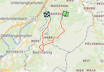

4,8 km | 8,9 km-effort


Tous les sentiers balisés d’Europe GUIDE+


Application GPS de randonnée GRATUITE
 SityTrail
IGN / Instituts géographiques
SityTrail World
Le monde est à vous
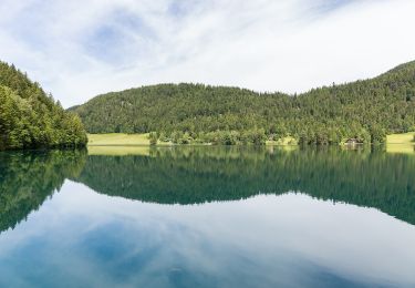
Randonnée A pied de 8 km à découvrir à Tyrol, Bezirk Kufstein, Gemeinde Schwoich. Cette randonnée est proposée par SityTrail - itinéraires balisés pédestres.
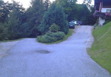
Randonnée créée par Gemeinde Bad Häring.
Symbole: Hellgrüne Schilder mit dunkelgrünem, oberen Rand und Richtungspfeil


A pied
A pied
A pied
A pied
A pied
A pied
A pied
A pied
A pied